top of page

PERSONAL & PROFESSIONAL PORTFOLIO
Branson T Fausey
Create Your First Project
Start adding your projects to your portfolio. Click on "Manage Projects" to get started
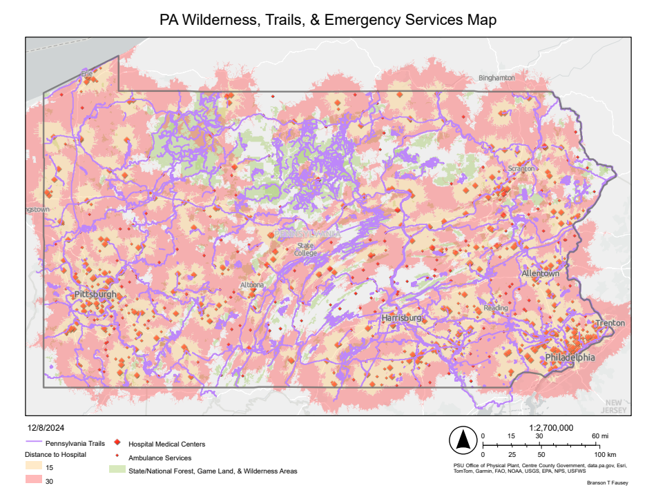
PA Wilderness & Emergency Services
Project type
Map
Date
December 2024
This map depicts all of Pennsylvania as areas of wilderness (State & National Forest, Game Lands, and Wilderness Areas) in relation to individual hospitals and emergency service centers by visualizing 15- and 30-minute drive times.
More specifically, the map shows which trails and wilderness areas are further from any potential emergency medical response, in an effort to encourage the viewer to stay safe in the woods. Because help might be a long ways away.

bottom of page